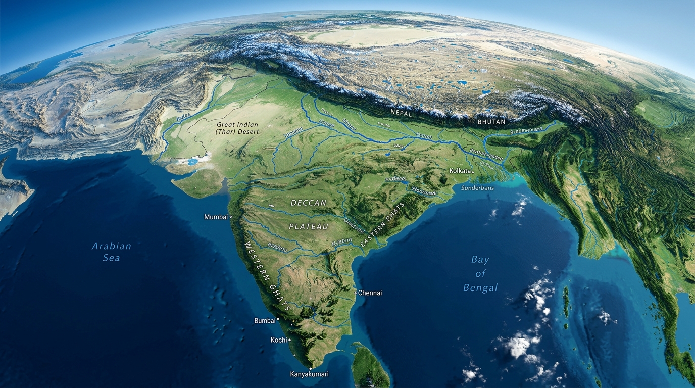
With 28 States and 8 Union Territories stretching across 3.28 million square kilometers, India presents one of the most astonishing geographic tapestries on the planet. Virtually every major landform found on Earth is represented within its boundaries.
From the world's highest salt desert in Gujarat to the living root bridges of Meghalaya's rainforests, let us embark on a regional tour highlighting the singular geographical marvels of Indian states.
Regional Geographical Highlights
| Region | Key States | Distinctive Geographical Formations |
|---|---|---|
| Northern Himalayas | Jammu & Kashmir, Ladakh, Himachal, Uttarakhand | High-altitude cold desert (Ladakh), U-shaped glacial valleys, Karewa soil formations (Kashmir saffron) |
| North-Eastern Hills | Assam, Meghalaya, Arunachal, Sikkim, Nagaland | Cherrapunji karst caves, living root bridges, Majuli river island, Kanchenjunga peak |
| Indo-Gangetic Basin | Punjab, Haryana, Uttar Pradesh, Bihar, West Bengal | Vast deep alluvial plains, Bhabar, Terai wetlands, Khadar-Bhangar flood zones, Sundarbans delta |
| Western Arid & Coastal | Rajasthan, Gujarat, Goa, Maharashtra | Thar Desert shifting sand dunes (barchans), Great Rann of Kutch white salt flats, Western Ghats escarpment |
| Peninsular Plateau & South | Madhya Pradesh, Karnataka, Kerala, Tamil Nadu, Andhra | Deccan Traps basalt lava plains, Nilgiri-Anamudi peaks (Western Ghats), backwaters (Kayals) |
1. Western and Arid Landscapes: Rajasthan & Gujarat
Rajasthan: Dominated by the ancient Aravalli Range—one of the oldest fold mountain systems in the world, heavily eroded into residual relict hills. West of the Aravallis lies the Thar Desert (Great Indian Desert), characterized by shifting sand dunes (*dhrians* and *barchans*), salty playa lakes (Sambhar Lake), and hyper-arid microclimates.
Gujarat: Boasts India's longest state coastline (1,600 km). Its most astonishing landscape is the Great Rann of Kutch—a seasonal salt marsh that transforms into an endless, blinding sheet of white salt crystals during the dry winter, and submerged wetlands during monsoons.
2. The Karst & Rainforest Wonders of Meghalaya and the Northeast
Meghalaya ("Abode of Clouds"): A plateau separated from the Chota Nagpur plateau by the Malda Gap. Composed of the Garo, Khasi, and Jaintia hills, it contains world-famous limestone karst caves (such as Krem Liat Prah) and the indigenous Jingkieng Jri—living root bridges trained by the Khasi people from the aerial roots of Ficus elastica trees across roaring jungle streams.
Assam: Defined by the mighty Brahmaputra river valley, home to the UNESCO World Heritage site Kaziranga National Park situated in the floodplains, and Majuli, the largest inhabited freshwater river island on Earth.
3. The Marine, Lagoon & Backwater Ecosystems of Kerala and Odisha
Kerala: Hugged between the towering Western Ghats and the Arabian Sea, Kerala features an intricate 900-kilometer network of brackish lagoons and lakes known locally as Kayals (such as Vembanad Lake). These interconnected waterways create a fertile coastal biome, including the Kuttanad region—one of the few places in the world where farming is practiced up to 3 meters below sea level.
Odisha: Home to Chilika Lake, Asia's largest brackish water lagoon, separated from the Bay of Bengal by a 60-kilometer-long sandspit. Chilika serves as a crucial wintering ground for over a million migratory birds and a haven for the endangered Irrawaddy dolphin.
4. The Deccan Volcanic Formations: Maharashtra & Madhya Pradesh
The Deccan Traps of Maharashtra were forged 66 million years ago by catastrophic volcanic fissure eruptions (the Reunion hotspot), creating step-like basaltic terraces and nutrient-dense black cotton soil (Regur). In Madhya Pradesh, the state forms the physical heart of India, where the Vindhya and Satpura ranges frame the rift valley of the sacred Narmada river.
Frequently Asked Questions
Conclusion
The geographic versatility of Indian states underpins the country's rich agricultural output, climatic diversity, and cultural identities. Each landscape tells a billion-year-old story of geological upheaval, river deposition, and natural wonder.
Next in Geography: Physical Geography of India · Major Rivers of India · Himalayan Mountains